En
Log in
All resources
Create a design
Tools
7,118 Free Images of Engraved Maps
baroque
engravings of topographia braunschweig lüneburg
national library of poland
maps from the earth and its inhabitants, vol. iv
british library
eran laor cartographic collection
copper engraving print
theatri praecipvarvm totivs mvndi vrbivm : liber sextvs (1618)
joan blaeu
matthäus merian
maps from the earth and its inhabitants, vol. vii
linguistic maps of chinese languages
maps from the earth and its inhabitants, vol. xv
19th-century maps of central america
maps from the earth and its inhabitants, vol. xiii
1878 maps of africa
maps from the earth and its inhabitants, vol. iv
huddersfield
maps from the earth and its inhabitants, vol. xiii
19th-century maps of namibia
maps from the earth and its inhabitants, vol. iv
portskewett
maps from the earth and its inhabitants, vol. iii
maps of the sava watercourse system
maps from the earth and its inhabitants, vol. iv
queensferry crossing
maps from the earth and its inhabitants, vol. vi
topographic maps of asia
maps from the earth and its inhabitants, vol. iv
eddystone rocks, devon
maps from the earth and its inhabitants, vol. iv
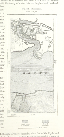
maps of dumbartonshire
maps from the earth and its inhabitants, vol. xvi
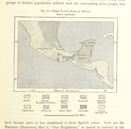
ethnographic maps of north america
maps from the earth and its inhabitants, vol. iv
firth of inverness
maps from the earth and its inhabitants, vol. iv
isle of thanet
mining in south africa
maps of vaal river
maps from the earth and its inhabitants, vol. vi
maps of kerch
maps from the earth and its inhabitants, vol. xvii
1870s maps of florida
maps from the earth and its inhabitants, vol. iv
snaith
maps from the earth and its inhabitants, vol. xvii
linguistic maps of north america
copper engravings in the universitätsbibliothek salzburg
wolf-dietrich-klebeband städtebilder
the war between the united states and mexico illustrated
maps of the mexican-american war
engravings by romeyn de hooghe
proveniershof, haarlem
americae 1562 by diego gutiérrez and hieronymus cock
renaissance
maps in the british museum
maps by john speed
de praecipvis totivs vniversi vrbibvs, liber secvndvs (1575)
maps of tunis by braun & hogenberg
st thomas's church, monmouth
welsh landscape collection
maps from university of amsterdam special collections
atlas der neederlanden
maps from university of amsterdam special collections
atlas der neederlanden
history of whitby, north yorkshire
british library maps collections
theatri praecipvarvm totivs mvndi vrbivm : liber sextvs (1618)
maps of čáslav by braun & hogenberg
theatri praecipvarvm totivs mvndi vrbivm : liber sextvs (1618)
maps of dillenburg by braun & hogenberg
theatri praecipvarvm totivs mvndi vrbivm : liber sextvs (1618)
maps of biecz by braun & hogenberg
theatri praecipvarvm totivs mvndi vrbivm : liber sextvs (1618)
maps of poznań by braun & hogenberg
theatri praecipvarvm totivs mvndi vrbivm : liber sextvs (1618)
maps of eisenstadt by braun & hogenberg
topographia braunschweig lüneburg (merian)
baroque
maps of paris from bibliothèque nationale de france
carte particulière des environs de paris
algiers in the 19th century
old maps of algiers
maps by thomas starling
1842 maps
charles william meredith van de velde
eran laor cartographic collection
engravings of topographia braunschweig lüneburg
baroque
carte de barbarie, nigritie, guinée par guillaume delisle (1707)
1718 maps of africa
old maps of hildesheim
baroque
maps of enns by braun & hogenberg
colored copperplate engraving
topographia franconiae (merian)
baroque
maps in the topographia austriacarum (merian)
baroque
engravings of topographia braunschweig lüneburg
baroque
maps of cochem by braun & hogenberg
engravings of topographia braunschweig lüneburg
baroque
engravings of topographia braunschweig lüneburg
baroque
engravings of topographia braunschweig lüneburg
baroque
engravings of topographia braunschweig lüneburg
baroque
engravings of topographia braunschweig lüneburg
baroque
engravings of topographia braunschweig lüneburg
baroque
engravings of topographia braunschweig lüneburg
baroque
engravings of topographia braunschweig lüneburg
baroque
maps in the library of congress
1758 maps of cuba
lawrence h. slaughter collection of english maps, charts, globes, books and atlases
maps by claude joseph sauthier
1780s maps of the world
german renaissance
engravings of topographia braunschweig lüneburg
baroque
engravings of topographia braunschweig lüneburg
baroque
engravings of topographia braunschweig lüneburg
baroque
engravings of topographia braunschweig lüneburg
baroque
engravings of topographia braunschweig lüneburg
baroque
engravings of topographia braunschweig lüneburg
baroque
engravings of topographia braunschweig lüneburg
baroque
old maps of the moon
tobias mayer
eran laor cartographic collection
william hole (engraver)
eran laor cartographic collection
william hole (engraver)
engravings by matthäus merian
baroque
eran laor cartographic collection
william hole (engraver)
eran laor cartographic collection
william hole (engraver)
voyages and travels to india, ceylon, the red sea, abyssinia, and egypt, vol. 2
henry cooper (engraver)
illustration
maps
encyclopédie méthodique - géographie physique
ambroise tardieu
maps from the earth and its inhabitants, vol. vii
charles eugène perron
engravings of topographia braunschweig lüneburg
baroque
engravings of topographia braunschweig lüneburg
baroque
engravings of topographia braunschweig lüneburg
baroque
algiers in the 19th century
old maps of algiers
18th-century copper engravings
jonas haas
atlas ou representation du monde universel t. 2 (1633)
1630s maps of virginia
birckenstein handgriffe (image set)
old maps of komárom
atlas ou representation du monde universel t. 2 (1633)
old maps of nuremberg
holy roman empire
pierre mortier
carte du mexique et de la floride by guillaume delisle (1703)
french-language maps of mexico
engravings by matthäus merian
baroque
maps from the earth and its inhabitants, vol. vi
alay district
maps of strasbourg in the 17th century
works by johann adam seupel
eran laor cartographic collection
pierre françois tardieu
carte de l'amérique septentrionale by guillaume delisle (1700)
1700 maps of north america
truscott map of st-petersburg 1753
copper
atlas ou representation du monde universel t. 2 (1633)
maps by hendrik hondius the younger
atlas maior, vol 4 (netherlands) - joan blaeu, 1667 - bl 114.h(star).4
1667 maps
atlas maior, vol 2 (sweden, russia, poland, eastern europe, and greece) - joan blaeu, 1667 - bl 114.h(star).2
17th-century maps of poland
maps from the earth and its inhabitants, vol. v
charles eugène perron
maps from the earth and its inhabitants, vol. vii
yarlung tsangpo
maps from the earth and its inhabitants, vol. viii
british raj
atlas maior, vol 7 (france i) - joan blaeu, 1667 - bl 114.h(star).7
1667 maps
atlas maior, vol 1 (northern europe, norway, and denmark) - joan blaeu, 1667 - bl 114.h(star).1
1667 maps
atlas maior, vol 1 (northern europe, norway, and denmark) - joan blaeu, 1667 - bl 114.h(star).1
1667 maps
2001 - 2100 of 7,118
Next page
/ 72